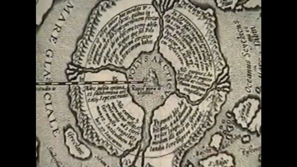
We continue our conversation with Harry Hubbard but move from the topic of the ancient repository at the Southern Illinois Cave site to evidence of a cavernous entrance at the north pole that could lead to the inner Earth. The evidence is based on Harry Hubbard’s presentation titled Lazeria Map collection. Together with his research colleague Paul Schaffranke, Harry combs through key maps from the 16th and 17th centuries showing evolution of coastlines, anomalous islands that may have sunk into the Arctic Ocean and the four islands at the North Pole separated by northward flowing rivers. We’ll hear accounts from 17th century explorers describing the regions at the top of the physical North Pole. This evidence has been engraved and printed by cartographers hundreds of years ago. It’s a matter of translating German, Latin and other early script, taking the time to read the detailed descriptions and that’s the work that Harry and Paul have done. Harry Hubbard joins us again to talk about this presentation, the Hollow Earth and early map references to Atlantis.